
Double click image to zoom in

Click image to open expanded view
You may also like
Stay in the Loop
Sign up for special offers, information on Kayak Demo Days, and more!
Canadian Owned Since 1998
Usually ready in 4 hours
Map Features: Attractions, ATVing, Camping, Fishing, Hiking, Hunting, Paddling, Skiing, Snowmobiling, Hydrology, logging and industry roads
Areas Covered: Banff, Canal Flats, Canmore, Cranbrook, Creston, Elkford, Fairmont Hot Springs, Fernie, Flathead, Golden, Invermere, Kimberley, Kootenay Crossing, Lake Louise, Parson, Radium Hot Springs, Rogers Pass, Sparwood, Yahk and more!
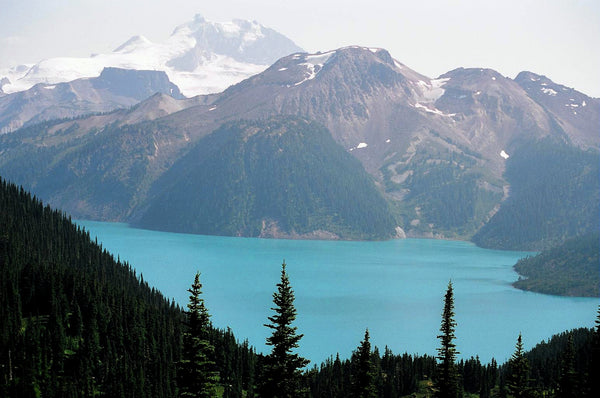
Tucked away in BC’s southeastern corner is one of the province’s most exciting outdoor adventure destinations – the East Kootenays are a land of deep lakes, crystal-clear rivers, towering mountains and wide-open valleys, where elk and moose roam the forests and trout lurk in hidden creek pools. This waterproof recreation map charts this entire region, from the healing waters of Radium Hot Springs to the mountain playground around Fernie, the wilderness of the Purcell Range and beyond. Brand new to this edition, we have expanded the map coverage north to include all of Banff National Park in Alberta, plus more of the Flathead area, the area north of Golden and even a portion of the West Kootenays. Whether you are looking to hike, camp, fish, paddle, swim, ski, snowshoe, hunt or ATV, this map provides you with the most comprehensive coverage of the area you will find anywhere.
This dual-sided 34” x 56.25” map is printed on durable, water-resistant paper to withstand any adventure and features industry-leading cartographic detail, state-of-the-art relief shading, colour coded Provincial Parks and more. To make navigating the East Kootenays even easier, we have added private leased lands to the map along with countless recreation Points of Interest, multi-use hiking and biking trails, motorized riding areas, campsites, backcountry huts and cabins, fishing lakes and rivers with marked fish species and stocking information, hunting zones, resource and logging roads and more. A handy index provides you with information on the area’s recreation sites (campsites) and trails, and we include a trail chart for the region’s National Parks. From Creston to Rogers Pass, Invermere, Kimberley and beyond, this is your ultimate guide to one of Canada’s premier outdoor recreation areas.
East Kootenay Waterproof Map at a Glance:
Serving Vancouver, Burnaby, Surrey and Beyond!
Skyview Outdoors
12355 Pattullo Pl,
Surrey, BC V3V 8C3
Canada
Sign up for special offers, information on Kayak Demo Days and more!