


Double click image to zoom in


Click image to open expanded view
You may also like
Stay in the Loop
Sign up for special offers, information on Kayak Demo Days, and more!
Canadian Owned Since 1998


Usually ready in 4 hours
Map Features: Attractions, ATVing, Camping, Fishing, Hiking, Hunting, Paddling, Skiing, Snowmobiling, Hydrology, logging and industry roads
Areas Covered: Abbotsford, Allison Lake, Boston Bar, Brookmere, Chilliwack, Coalmont, Garibaldi Prov. Park, Harrison Hot Springs, Hedley, Hope, Manning Prov. Park, Merritt, Princeton, Squamish, Tulameen, Vancouver, Whistler, and more!
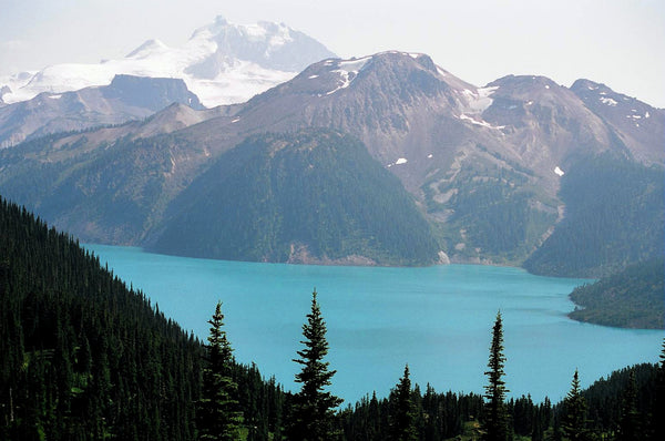
overing the southwest corner of British Columbia, the Squamish, Chilliwack and Merritt area boasts some of the greatest outdoor adventure opportunities in Canada. This is one of the only places in the world where you can paddle an ocean kayak in the morning and ski or snowboard at a world-class downhill resort in the afternoon. The area around Squamish is renowned for its rock climbing opportunities, while the mountains of Vancouver’s North Shore are regarded as the birthplace of freeride mountain biking. Heading east, the resort town of Harrison Hot Springs offers therapeutic soaks and stunning lake views, while the town of Hope serves as the gateway to the BC interior including the lush forests of Manning Provincial Park and the high alpine wilderness of Cathedral Provincial Park. To the north, the area around Merritt offer hundreds of incredible fishing lakes, while heading further east into the Similkameen Valley gives you a taste of BC’s wine country.
This dual-sided, 34” x 56.25” map is printed on durable, water resistant paper and features our industry leading cartographic detail and state of the art topographic relief and shading. Covering the area around Whistler, Squamish, Vancouver, Chilliwack and Harrison Hot Springs on one side, and Hope, Boston Bar, Merritt and Princeton on the other, this is the most detailed and easy-to-use recreation map for this region available anywhere. With clearly defined Wildlife Management Units, multi-use trails, fishing hot-spots, paddling routes, rec sites, national and provincial parks and much more, no other map provides you with this level of detail or this much recreation information for the Squamish, Chilliwack and Merritt area.
Squamish, Chilliwack and Merritt BC Waterproof Map at a Glance:
Serving Vancouver, Burnaby, Surrey and Beyond!
Skyview Outdoors
12355 Pattullo Pl,
Surrey, BC V3V 8C3
Canada
Sign up for special offers, information on Kayak Demo Days and more!